STATEMENT
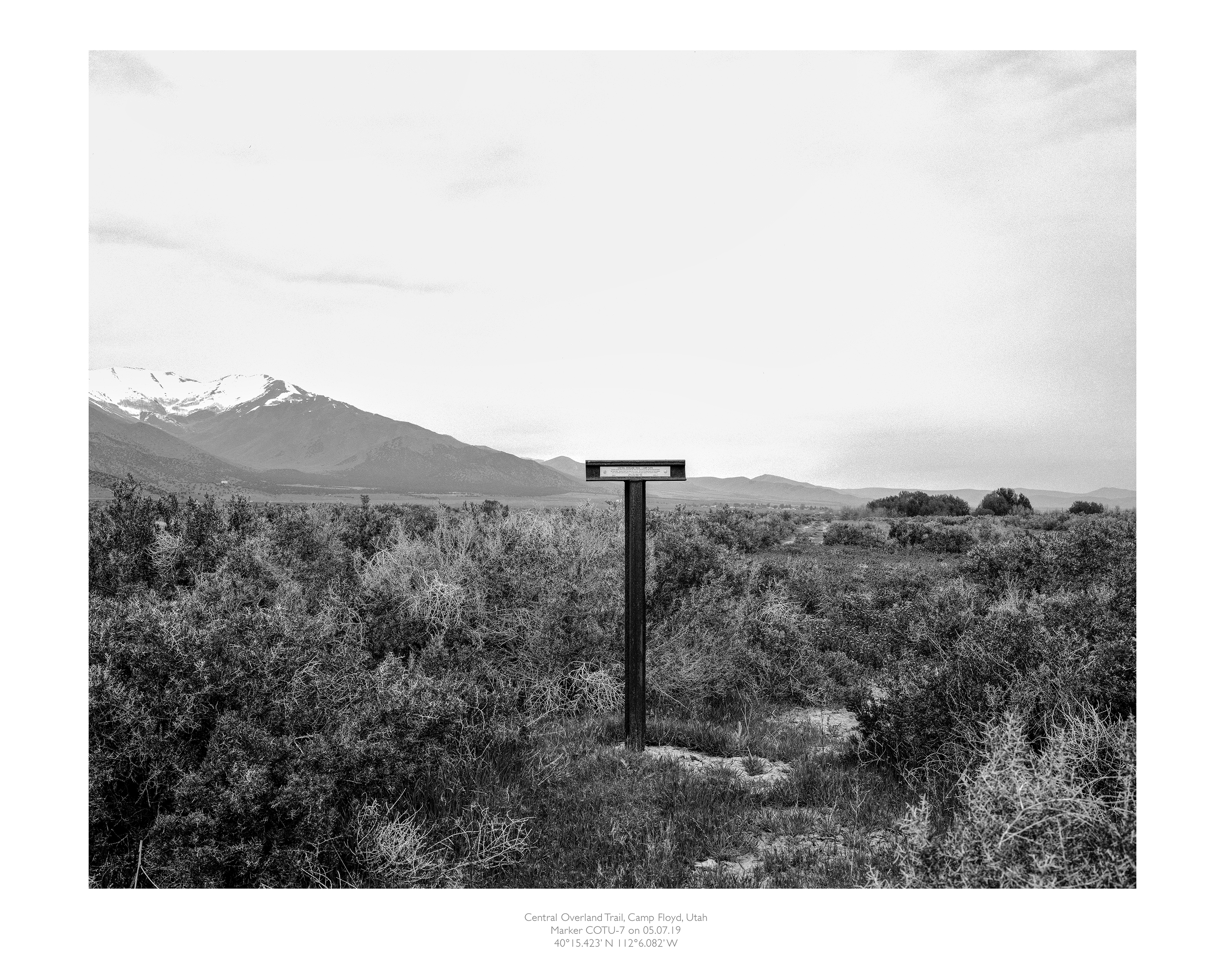
For this project I have been photographing the California Emigrant Trail in the western United States. In 2017, I was out photographing the desert in Nevada and I noticed a marker for the Emigrant Trail. I had seen the markers before but had never really stopped to investigate. Upon returning home I did some research and found an auto guide to the trail that started at the Nevada/Utah border and went west to California. I thought it was fascinating that the trail still existed considering it was over 150 years old. Auto guide in hand, I decided to see if I could follow the trail across Nevada into California. As it turned out the trail is very well marked and maintained by a non-profit historical group: Trails West. They have installed markers that make it possible for interested people to follow the routes of the settlers heading west.
The guide contains excerpts from the pioneers personal diaries illustrating the difficulty and hardships people must have faced heading west to find a better life. Many of them gave up and lost everything including their lives.
The Nevada section of the trail was the most arduous since it crossed the Forty Mile Desert. "Long before sunrise our teams were on the trail marching forward on the desert...very little to see save the dusty brightness of the glittering sand...now and then a grave and dead stock." John Clark of Virginia, August 2, 1852
Over 250,000 people traveled along the California Emigrant Trail from 1849 To 1869 ending with the completion of the transcontinental railroad. As a result of the Gold Rush many new routes were opened into California. They were continually modified, tested or even abandoned. The trails continued to be used as stage and supply routes into the early 20th century.
Over the fall of 2018, I began seriously making photos of the trails and the landscape. I took three trips that year and made my way across Nevada and into eastern California. All in all, I managed to find and follow about 47 markers.
My process is to photograph from the actual trail. For example, in the Landscape section I make the picture as I stand on the trail. To keep track of my location, I make reference shots using my iPhone. This gives me exact GPS information, location, time and date. The information from my iPhone comes in handy as many of the pictures look the same. It also allows me to map where I have photographed along the trail. After I develop the film, I scan and print it at my studio. On the print I include information such as: trail name, state, county, date, etc.. Since 2018, I have continued to make photographic trips into Wyoming, Idaho, Utah, Nevada and California documenting the trails the settlers took during the California Gold Rush.